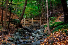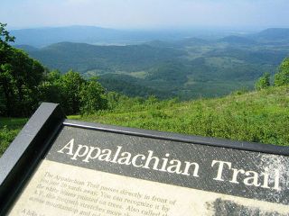
 The Appalachian Trail is more formerly known as the Appalachian National Scenic Trail and runs from Mt. Katahdin in Maine to Springer Mountain in Georgia which encompasses a distance of nearly 2,200 miles. The trail is regularly maintained by 30 multiple partnerships and trail clubs. The trail is primarily located in wilderness areas although there are portions of it that cross rivers, skirt towns, and travel roads.
Anthony's Nose above the Hudson River – The first half-mile is fairly steep and climbs 500 feet along Anthony’s Nose. It starts after you use the Bear MountainBridge to cross the Hudson River and offers some excellent views of the river valley. The total round trip is 2.2 miles.
Deep in the Delaware– This 15.9-mile (one-way) travels along the ridgeline that sits 1,000 feet above the Delaware River. This section also traverses the Kittatinny Ridge and provides you with a stop at Sunfish Pond. Additionally, a side trip will take you to the top of 1,527-foot high Mount Tammany.
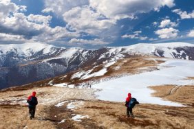
The Carter Range from Pinkham Notch to the Androscoggin River – This is another excellent backpacking trail that travels 21.1 miles one way. The entire trail winds around the White Mountains with nearly 20 miles of it situated above the tree-line. It is filled with some spectacular mountains and panoramas.
The Rangeley Lakes Region from Route 4 to Route 27 – Both beautiful and rugged, this hike captures the pure essence of the Appalachian Trail in the state of Maine. Your adventure begins near the small town of Madrid and meanders across Crocker, Saddleback, and Sugarloaf Mountains. It also stops along shorelines of some very pristine mountain ponds along the way. (Distance: 32.2 miles one-way)
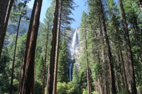
30-Mile Wilderness Section of the 100-Mile Wilderness – The 100-mile Wilderness is the only section of the Appalachian Trail that never crosses a paved road. It begins in the town of Monson, Maine. The first 30 miles of the entire trip contain some of the better highlights of your journey including 360° views of the Barren-Chairback Range, 60-foot high Lower Wilson Falls, rock-laden rivers, and a sugar maple forest. There are excellent campsites for backpackers all along the trail and even four shelters. The trail concludes at a waterfall-filled slate gorge near KI Road.
Blue Mountain from Port Clinton to Lehigh Gap – During the fall over 20,000 migrating raptors can be seen in flight as they head south. The hike takes in a lengthy stretch of Blue Mountain ridgeline along the way and provides the hiker with some panoramic views of the pastoral Pennsylvanian countryside in the process. Other viewpoints along the route include Bake Oven Knob, the Cliffs, and the Pinnacle which many hikers have claimed as the best part of the Appalachian Trail in the state.