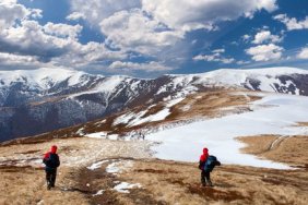
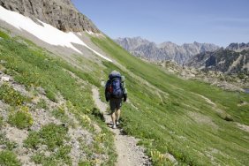
 I believe that any hiker or camper who loves long trips, far from the noise and chaos of busy city life, should invest in a good handheld GPS unit. However, I also strongly believe that every outdoorsman should be knowledgeable on the basics of outdoor survival. This includes knowing how to build a fire without matches or a firestarter, how to signal with a mirror or smoke, and how to navigate using a compass and a map. Many think that they already know how to use a compass in conjunction with a map. However, there is a proper way to utilize this invaluable tool and knowing the correct method can mean the difference between a minor setback and a disaster.
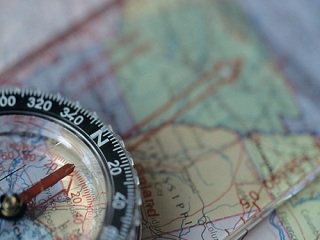
Compass design hasn’t really changed much over the years. They consist of a 360-degree circular face, with degrees broken down in increments of five or ten. Usually, the face will spin and there will be an arrow at the top. The concept of a compass seems simple enough to most; hold it in front of you and the needle will point “true north.” This first step is where the vast majority of people go wrong. Contrary to popular belief, compasses do not point towards “true north,” but instead point towards a concentration of magnetic activity near Canada’s Hudson Bay area. Grasping this fact will help immensely, in relation to using a compass with a map.
To use a compass with a map, you’ll need to know in which direction you want to travel, in relation to “true north.” This can be done two ways. First, you can place a protractor on your location and simply line up the protractor with your desired destination. From there, the protractor will give you a degree measurement. Another method involves using your compass, as well as a straight edge. Here, however, you must also factor in your map’s magnetic declination. Let me break it down: Let’s say you need to travel 160 degrees to get from your water source back to camp, and your map’s declination is 9 degrees less than “true north.” In that case, you would line up the arrow on your compass with 169 degrees, and after aligning the needle towards “true north,” the arrow would then point towards the direction you need to travel.
If you should get lost, try to reach a high vantage point and locate a landmark that coincides with tour map. Once you do this, use your compass to reach this point, if it’s something like a road or a ranger station.
A compass and a map may seem like primitive methods of navigation, but I guarantee that learning this easy, but vital, technique can save lives. GPS units can run out of batteries, lose satellite signal, or be lost altogether, leaving you with nothing if you didn’t head out with a compass. At the end of your trip, it may be the only thing to help you find your vehicle, which some of us think is pretty important.