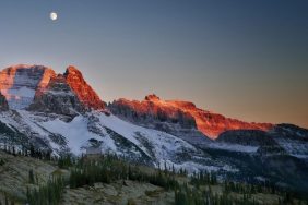

If you’re looking for a hike that offers beauty and adventure, Utah should be high on your destination list. The state offers dramatic views and challenging environments to explore in some of the country’s most unique hiking areas.
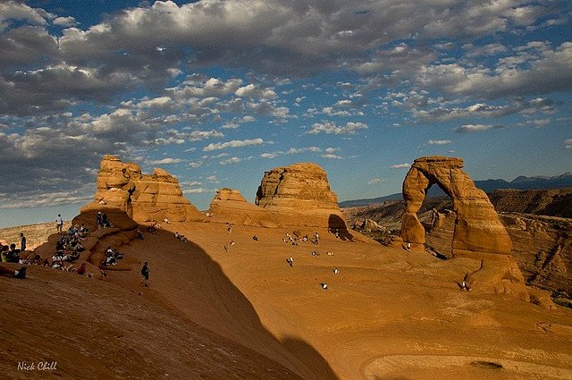
Delicate Arches, Arches National Park
The much-photographed Delicate Arches in Arches National Park is a site worth seeing, but the hike to view it up-close is not a stroll, so bring plenty of extra water and wear good hiking shoes. There’s not much shade along the trail for this moderately strenuous hike. Located in the east-central area of the park, it’s about a 3-mile round trip, with a trail that gradually slopes upward as you approach the arch. Midday hikes can be very hot in the summer months, but it’s a pleasant hike during earlier morning and evening hours. Steps are carved into the sandstone in the steeper sections – the total elevation gain is a mere 480 feet. With a wide and smooth trail, walking some portions is easy as long as you stay clear of the edge where a sheer cliff falls off on one side. The park is five miles north of the town of Moab, Utah, and features a trailhead parking area. Overflow parking is not allowed, so it’s best to get there early to avoid any hassles. The trailhead is at Wolf Ranch, where you’ll get to see a fascinating panel of Native American rock art attributed to the Ute tribe.
Rattlesnake Creek Trail, Cedar Breaks National Monument
Native Americans called Cedar Breaks the “circle of painted cliffs.” What they were describing is actually a giant amphitheater whose floor is a maze of spires, pinnacles, columns and arches. To see this natural wonder requires a strenuous 9-mile hike on the Rattlesnake Creek Trail, but the amazing views are a fitting reward for the effort. The trail drops steeply – 2500 feet over a 4 mile section, making this hike one for the fit and adventurous. Keep on the lookout for elk among the variety of evergreen and Bristlecone pine strands, and check the weather forecast before you head out in case of flash floods in the narrow gorges. Trail markers are poor or non-existent in some places so it helps to have map reading skills and to purchase a topographical map at the Visitor’s Center of the Ashdown Gorge Wilderness Area. Located just outside Zion National Parks north entrance, this trail intersects with Ashdown Creek. Hikers can also follow the creek upstream to the canyons.
Peekaboo Trails, Bryce Canyon National Park
The Peekaboo Trails is a loop that weaves through a collection of hoodoos – bizarrely shaped rock formations – fins and spires in the Bryce Canyon National Park. Hikers take a steep 1.15 mile trail before arriving at the start of the 6.5 mile loop, beginning at Bryce Point where there’s a rangy view of the canyon. This hike packs a lot of fascinating scenery into a condensed area, especially as you make your way down the 831 feet descent below the canyon rim. For the signature hoodoo hike, work clockwise from Sunrise Point and descend to the Queen’s Garden Trail to meet up with the Peekaboo Trails, and climb past the towering sandstone spires in the area. There’s even a very popular full-moon hike, sans flashlights, that turns the oddly shaped hoodoos into a dream-like and somewhat eerie nighttime experience.
Angels Landing, Zion National Park
This hike at Angels Landing in Zion National Park is one of the most thrilling in the entire national park system, but it’s not a good choice for those with any fear of heights: it runs along a narrow rock fin with dizzying drop-offs on both sides of a difficult trail, and ends at the top of a towering monolith with chains to grip during the final extremely steep half-mile trek to the summit. Don’t be fooled by the easy beginning. The trailhead starts near the Grotto picnic area and the climb is gradual through slopes dotted with pinon and juniper trees. The challenging section begins in an area called Walter’s Wiggles, a series of 21 very steep, super tight, zigzagging switchbacks that are similar to a spiral staircase carved into the huge block of sandstone. The last half-mile is strenuous and scary, with a very narrow path and deep drop-offs. Keep off this trail when it’s wet, rainy, or icy and plan to be off well before dark. This is definitely not a trail for children. As intimidating as portions of this trail are, it’s wildly popular with hikers who know the panoramic view from the top is worth the 5-hour average time it takes to get there.
Photo credit: Flickr Creative Commons